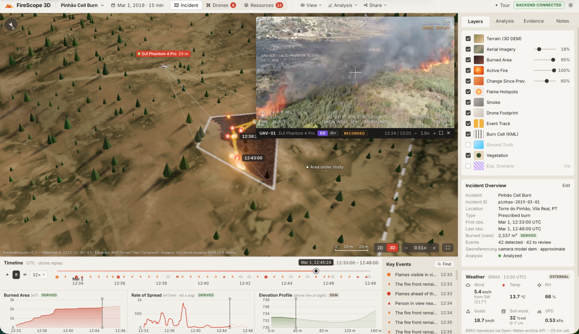
FireScope 3D turns drone footage into an interactive, evidence-linked 3D wildfire analysis platform for emergency responders.
Using real footage from the BurnedAreaUAV prescribed-fire dataset in Portugal, our computer vision pipeline identifies burned areas and visible fire activity, projects observations onto real elevation data, and reconstructs fire evolution along an interactive timeline. Users can explore 3D terrain, inspect historical changes, select events and jump directly to supporting video.
NVIDIA Cosmos Reason analyzed 41 real video clips to generate scene descriptions and fire-related observations. Cosmos Embed1 enables semantic video search, while YOLO11 detects relevant objects. VAST Data provides video archive search and retrieval through its indexed infrastructure. CoreWeave hosts GPU inference, and Weights & Biases powers grounded AI question-answering. Cursor helped develop and deploy the application on the workshop's Kubernetes infrastructure.
The dashboard also features six drone entities and 13 response resources, with cinematic camera views, aircraft movements and operational visualizations. Synthetic telemetry, resource operations, false-color infrared views and experimental projections are explicitly labelled as simulated.
FireScope is an exploratory decision-support prototype, not a certified wildfire prediction system.

 SpaceXAI (Cursor)
 CoreWeave (Weights & Biases)
 NVIDIA